Gulgan Village
A concise overview of the project vision, Planning Proposal, DCP and VPA currently on exhibition.
Answering the questions that matter to the local community.
What is Gulgan Village?
Gulgan Village is a proposal for a new village near The Saddle Road, between Brunswick Heads and Mullumbimby. It sets out to deliver the kind of housing and community the Byron Shire genuinely needs, on land already identified as suitable by both Council and the NSW Government.
It's a village set within the landscape, not a conventional subdivision. The Northern Rivers has always been a network of villages; compact settlements in open, green settings, and Gulgan Village continues that tradition.
The Planning Proposal would allow for between 400 and 550 homes across a range of types: smaller, lower-cost dwellings, terraces and row housing, low-rise apartments, larger family lots, co-housing, and manufactured homes. Housing that suits the people the Shire is struggling to house (key workers, young families, downsizers and locals priced out of the market) with walkable streets, shared open spaces and a small village centre. It draws on New Old Ways, a framework for responsible, place-based development, published by Creative Capital.
→ Have your say
→ Read the documents
→ Ask us a question
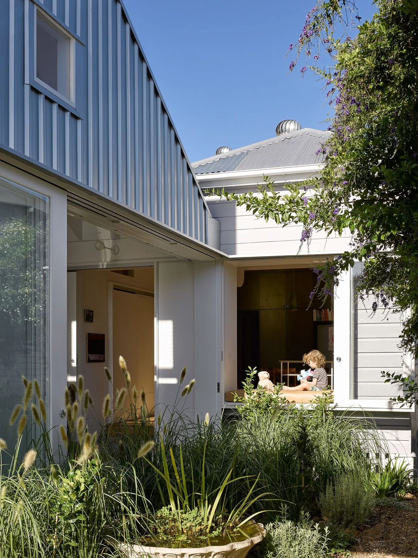

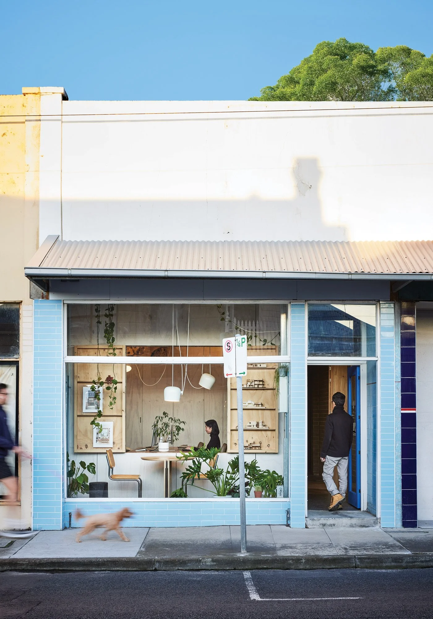
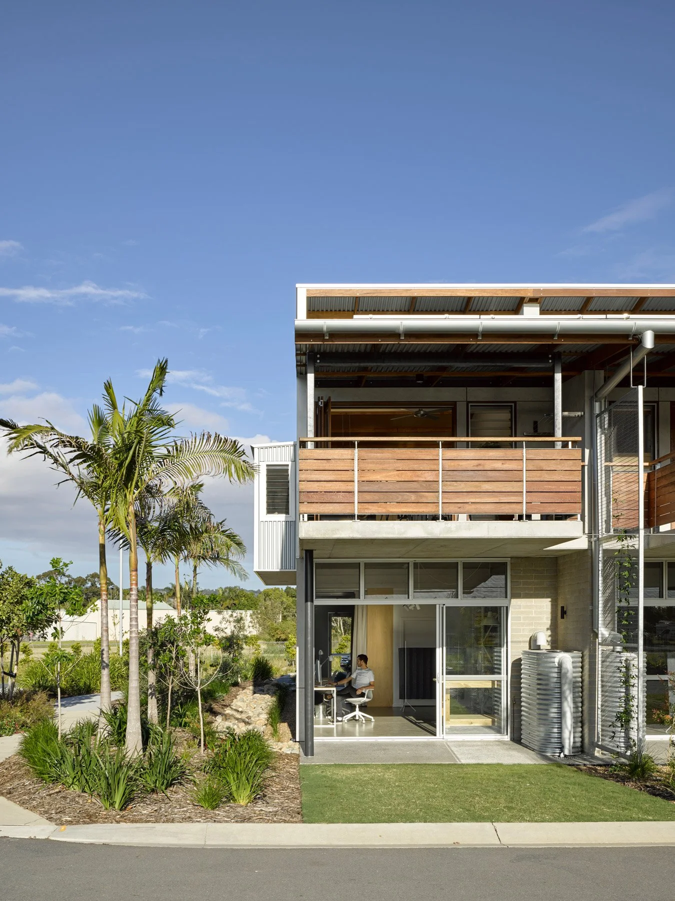
Image: Annerley House by zuzana&nicholas. CFJ Photography
Our Approach
The site's vegetation, habitat, significant trees and ecological values were mapped first, and the village shaped around them. Homes sit on already-cleared paddocks, the established trees and bushland are kept almost entirely, and new planting extends habitat rather than fragmenting it. The Saddle Road would become a green spine of walking and cycling routes.
The Arakwal people have been involved throughout, and the village's design will be guided by a Country-centred framework, prepared with First Nations expertise, before any building begins.
There's community built in, too. A not-for-profit housing project, delivered with Byron Shire Community Housing, sits within the village, and the proposal commits 5% of homes as affordable housing, plus a further 5% directly to the Bundjalung of Byron Bay (Arakwal) Aboriginal Corporation for housing on Country.
It's an uncommon combination: flood-free, cleared, well-located land, identified for housing by Byron Shire Council in its Residential Strategy 2041 and by the NSW Government in the Northern Rivers Resilient Lands Strategy, and backed by a full suite of independent studies. It's a rare opportunity to plan a neighbourhood from first principles.
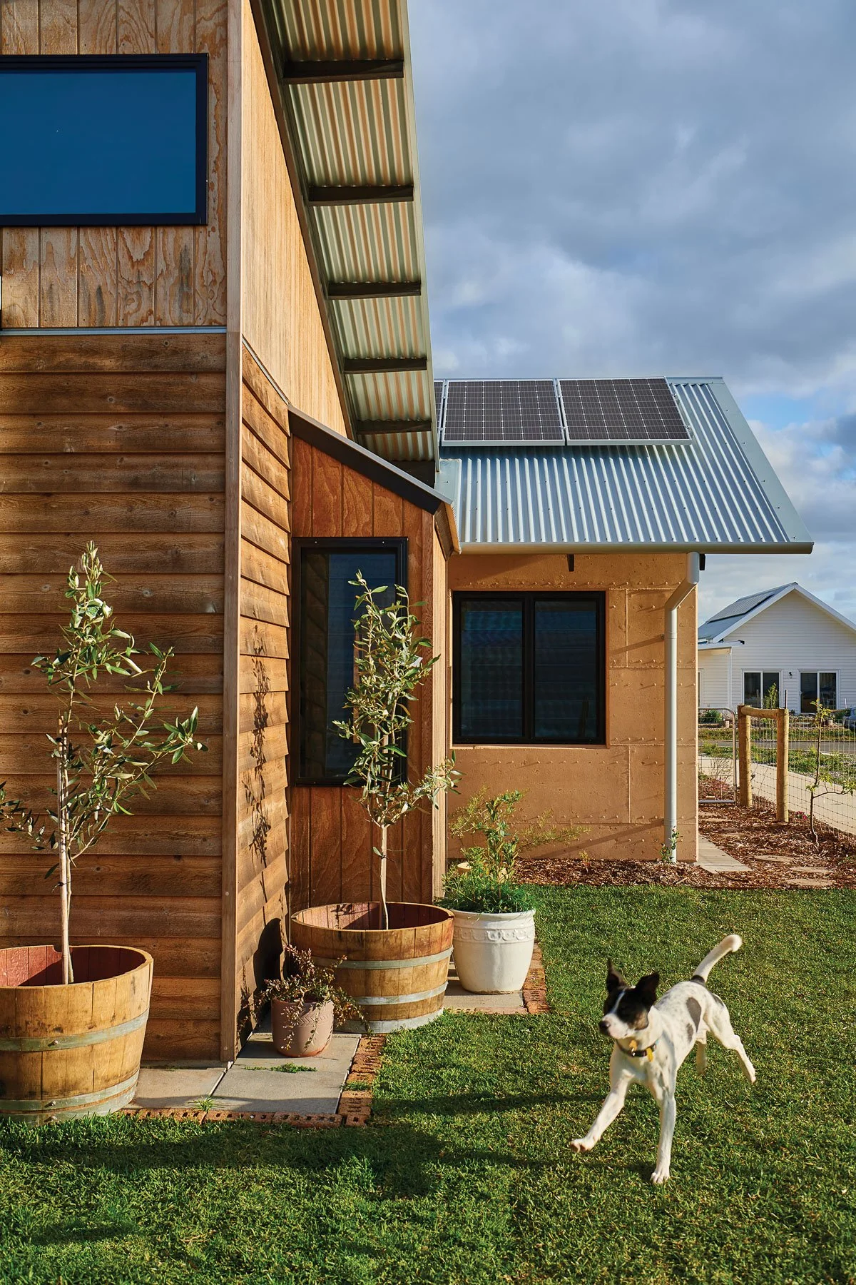
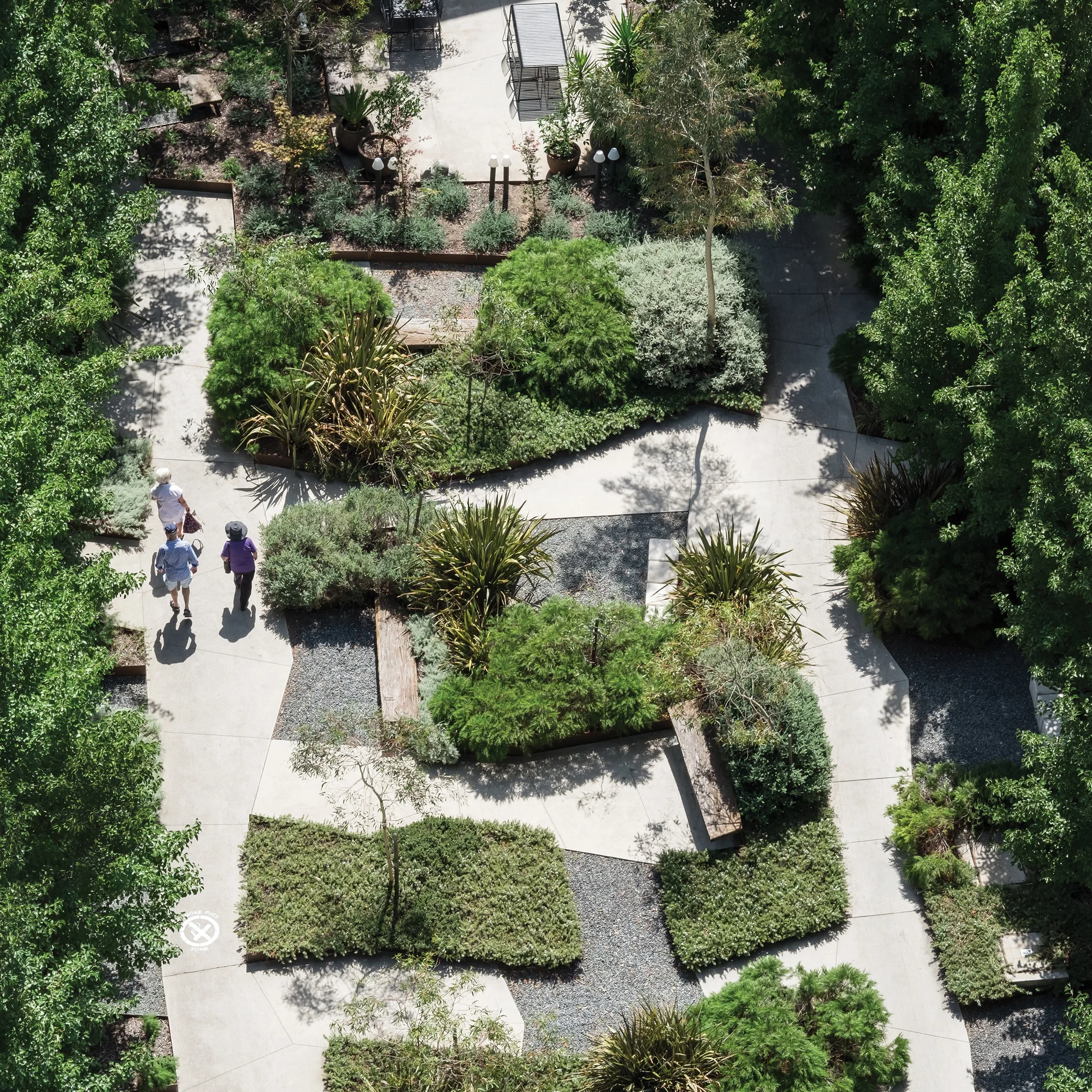
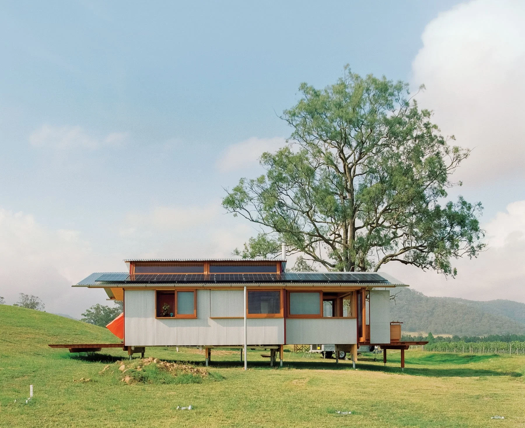
Images: reference images to help convey the scale, architectural language and material palette anticipated for the built form.


Where we’re at
The Planning Proposal, draft Development Control Plan (DCP) and Voluntary Planning Agreement (VPA)are on public exhibition until 12 July 2026. This is the formal stage where the community can read what's proposed and have their say, before Council considers all submissions and decides whether to take the next step.
This website is the home for clear, current information while it's on exhibition, explaining each of these documents in plain language. It will be kept up to date as the proposal progresses.
It's worth being clear about what is, and isn't, being decided. This stage is about changing the planning rules for the land. It does not approve any building. Even if all three are approved, the land would still have to go through separate development applications and construction certificates before it could be subdivided or any homes built, each assessed against the new rules, with further opportunities for the community to have a say. Rezoning is the careful, staged, public beginning of the process, not the end of it.
What's on exhibition
Three documents are on exhibition together, and they work as a set. Here's what each one is:
-
The formal first step in changing the planning rules for the land. It asks the NSW Government and Council to amend the Byron Local Environmental Plan 2014 (the legal document that sets what land can be used for) to rezone the site from rural to a mix of residential and conservation zones, and to set the controls (heights, density and so on) for a village of 400–550 homes → More on the Planning Proposal page.
-
Sits beneath the LEP and guides how development happens: street layout, lot sizes and mix, building envelopes, landscape, drainage, bushfire protection and staging. The draft DCP (Chapter E12) is written specifically for Gulgan Village. It guides and controls, it doesn't itself approve any building. → More on the Draft DCP page.
-
The Voluntary Planning Agreement — an agreement with Council in which the developer commits to deliver public infrastructure (water, sewer and road upgrades) and a contribution toward affordable housing under Council's Affordable Housing Contribution Scheme. → More on the Planning Proposal page
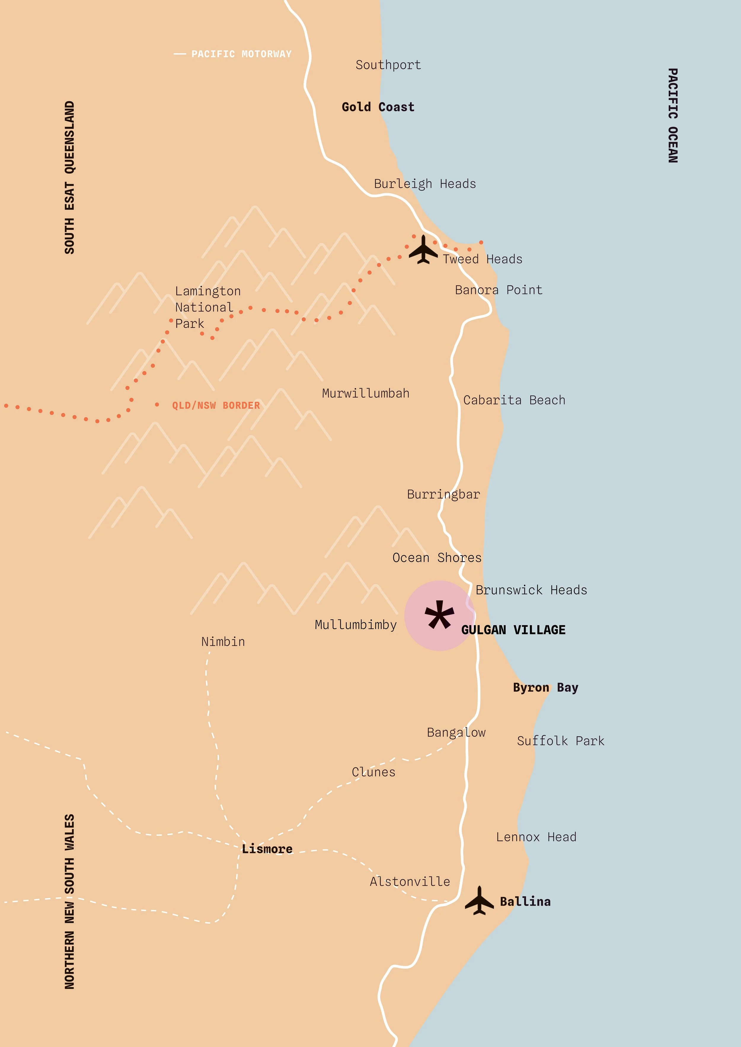
Location
Address
66 & 132 The Saddle Road, Brunswick Heads, NSW 2483
Lot / Plan
DP 1159910 + DP 1018929 (plus two Council water-reservoir lots)
Total Site Area
Approximately 82 hectares
Land Rezoned to R1
Approximately 37.9 hectares
Net developable area
Approximately 13.17 hectares
The site sits either side of The Saddle Road in the north of Byron Shire, on elevated, flood-free land directly west of the Pacific Motorway (M1). Although the holding is large, only a small part of it would be built on: around 13 hectares is developable, with the majority retained as conservation, open space and rural landscape. It's well connected to the towns and services nearby:
Brunswick Heads — about 6 minutes
Mullumbimby — about 9 minutes
Byron Bay — about 16 minutes
Ballina Byron Gateway Airport — about 30 minutes
The Saddle Road follows the ridgeline through the site, forming a green corridor through the village. To the east is the Pacific Motorway; to the south, Gulgan Road. Immediately to the south-east is BILS Area 5, a separate, already-approved precinct of employment land. The two have been planned alongside one another, putting homes within walking distance of local jobs: a genuine working village, not a dormitory suburb.
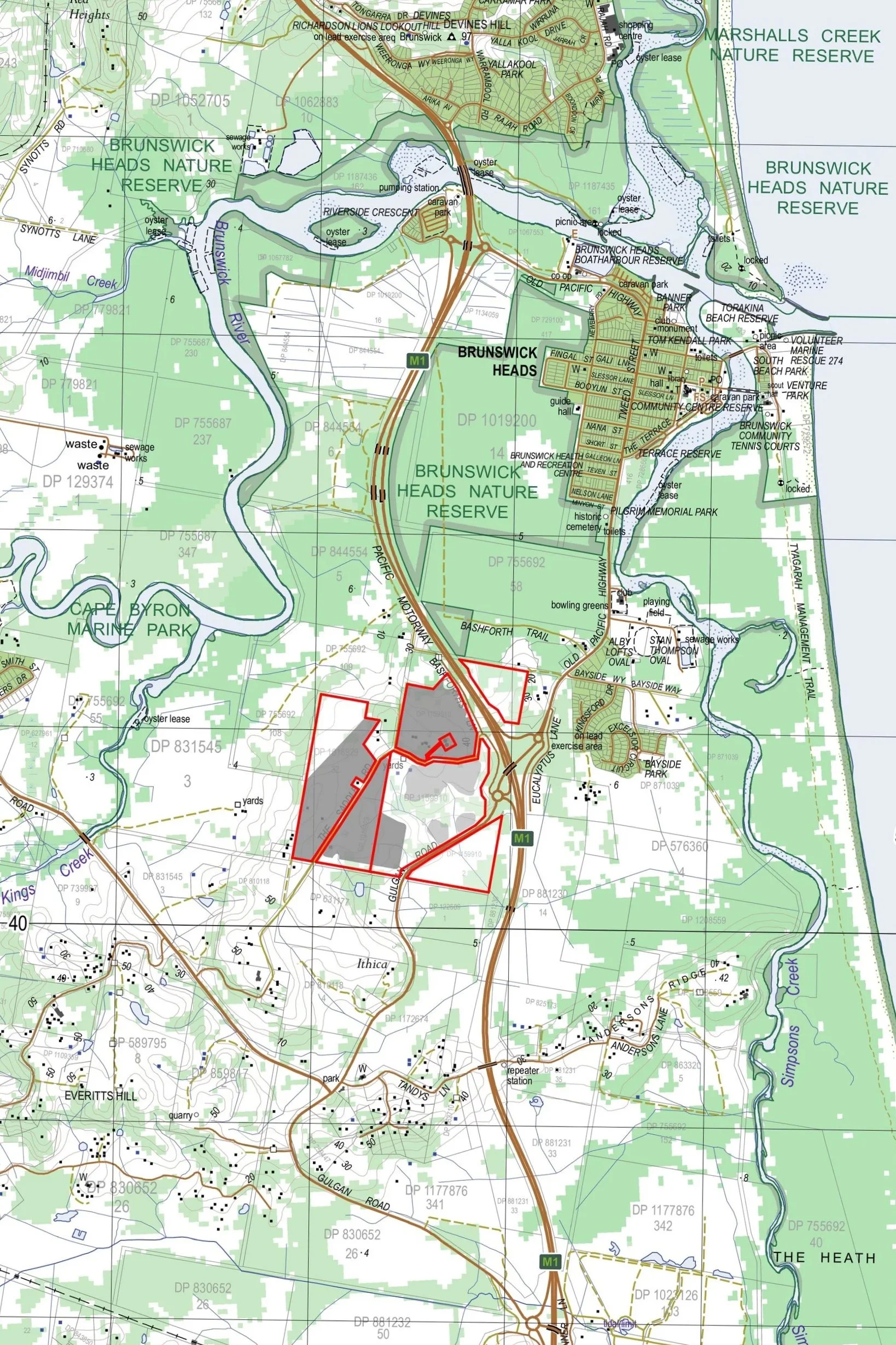
The Site
The land is elevated and gently undulating: cleared, degraded former farmland of low agricultural value, made up of open, exotic-grass paddocks with pockets of remnant vegetation and stands of significant trees that the plan retains. Importantly for this region, it is flood-free, sitting above the 1% annual flood level and outside the probable maximum flood area.
The Saddle Road runs along the ridgeline beneath an established canopy of trees, with long views from the higher ground to Mount Chincogan and Cape Byron. The land also takes in Byron Shire Council's existing water reservoirs on the ridge, and the village would draw its water from this Saddle Road supply, with land set aside under the planning agreement for an additional reservoir to serve later stages.
It's identified as Area 16 in Council's Residential Strategy 2041, and as Site B1 in the Northern Rivers Resilient Lands Strategy (shown on the context map), recognised at both local and State level as suitable for new housing. Only around 13 hectares is developable; the balance is retained as conservation, environmental management and rural landscape, keeping the village within a green setting.


Images below: Reference images to help convey the scale, architectural language and material palette anticipated for the built form.


The Team
Gulgan Village has been developed by a Byron-based team, with specialist consultants advising on every aspect of the proposal.
Creative Capital
Development management, design and strategy
Planners North
Lead planning consultants
Balanced Advice
Statutory and strategic planning advice
Simpson & Wilson
Urban design
Design Team Ink
Visual impact and landscape character
INGEN Consulting
Civil and traffic engineering
Bower Ecology
Ecological assessment and biodiversity
John Allen & Associates
Agricultural assessment
Tim Fitzroy & Associates
Acoustics, land-use conflict and site contamination
Everick Heritage
Aboriginal cultural heritage
McCartney Young Lawyers
Planning agreement
Australian Bushfire Protection Planners
Bushfire planning
Timeline