Draft Development
Control Plan
A closer look at what the Development Control Plan is, what it controls, and how it would shape the village.
What is a Draft Development Control Plan?
If the Local Environmental Plan (LEP) decides what can be built on a site, the Development Control Plan (DCP) decides how it's built: the layout of streets, the size and mix of lots, building envelopes, landscape, drainage, bushfire protection and the order things are built in.
The two are separate documents. The Byron Local Environmental Plan 2014 is the legal instrument that sets land use and the headline limits; the Byron Development Control Plan 2014 sits beneath it and fills in the detail. The Planning Proposal on exhibition would change the LEP so a village can be planned here; this draft DCP is a new chapter of the DCP that would guide how that village is designed and assessed.
A DCP guides and controls; it doesn't itself approve anything. Every future development application is assessed against it, and where the LEP or a State planning policy says something different, they override the DCP. It's one of the key ways the quality of the village is held in place over time.

Image: Easy Street, Habitat Byron Bay, CFJ Photography
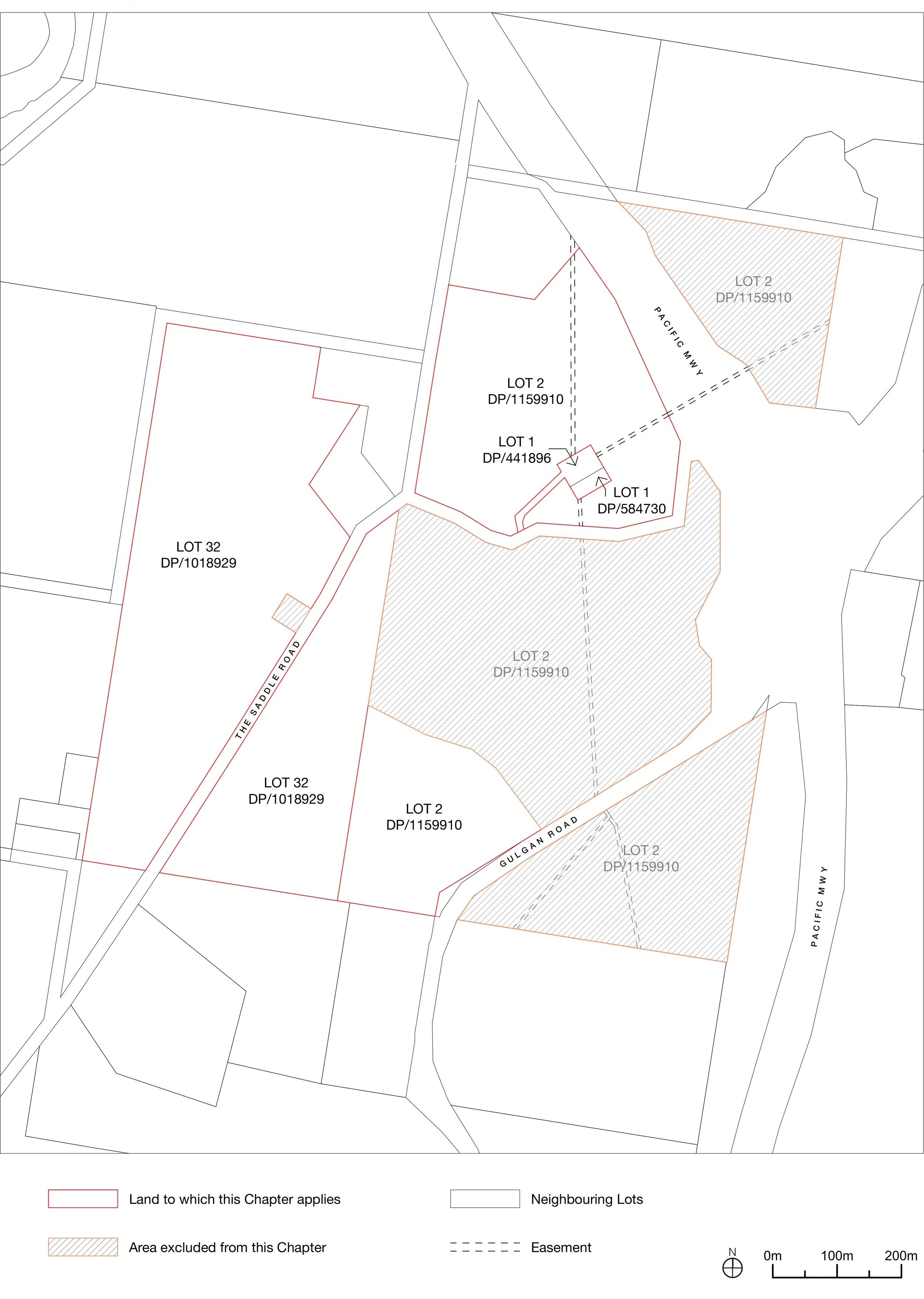
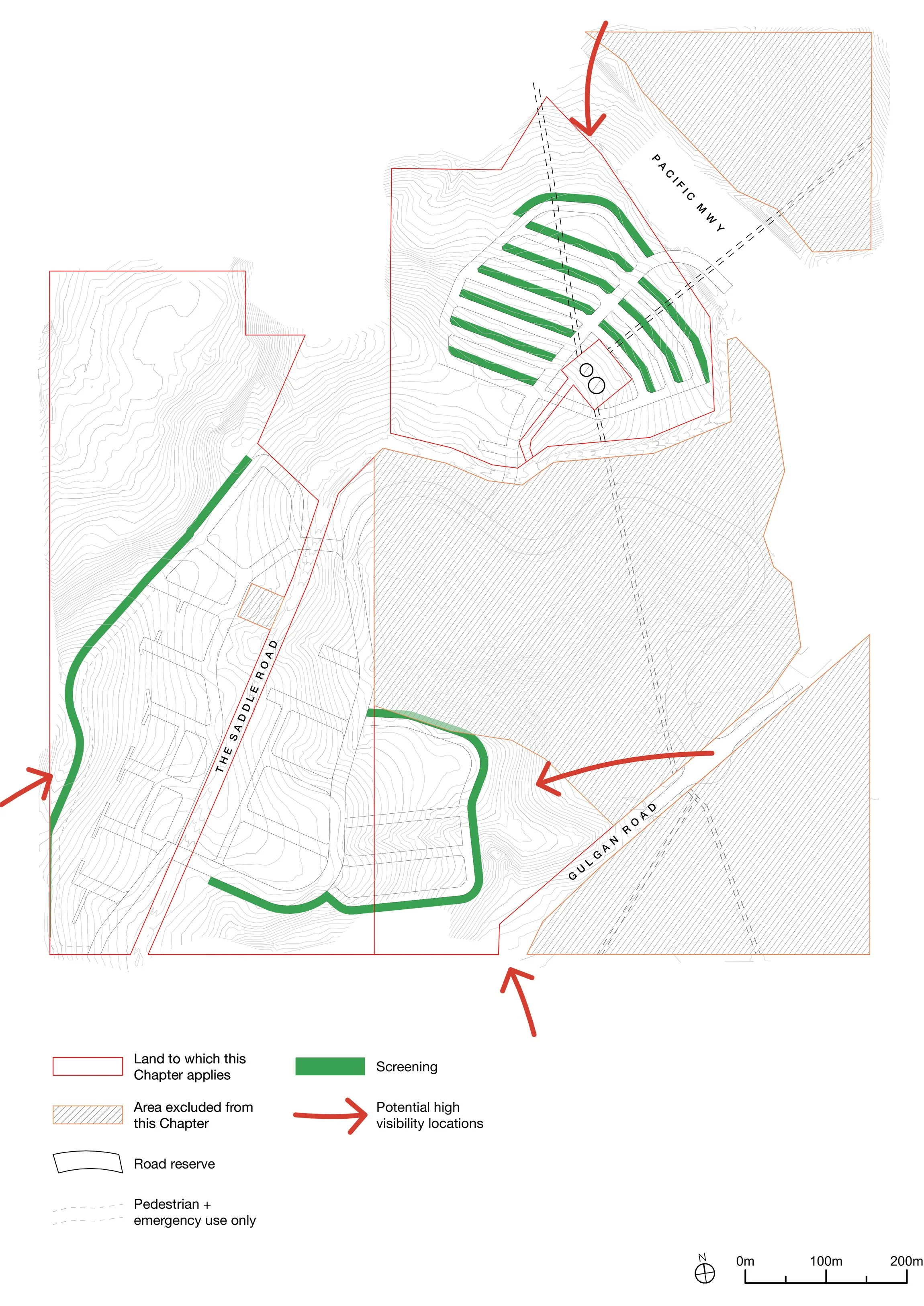
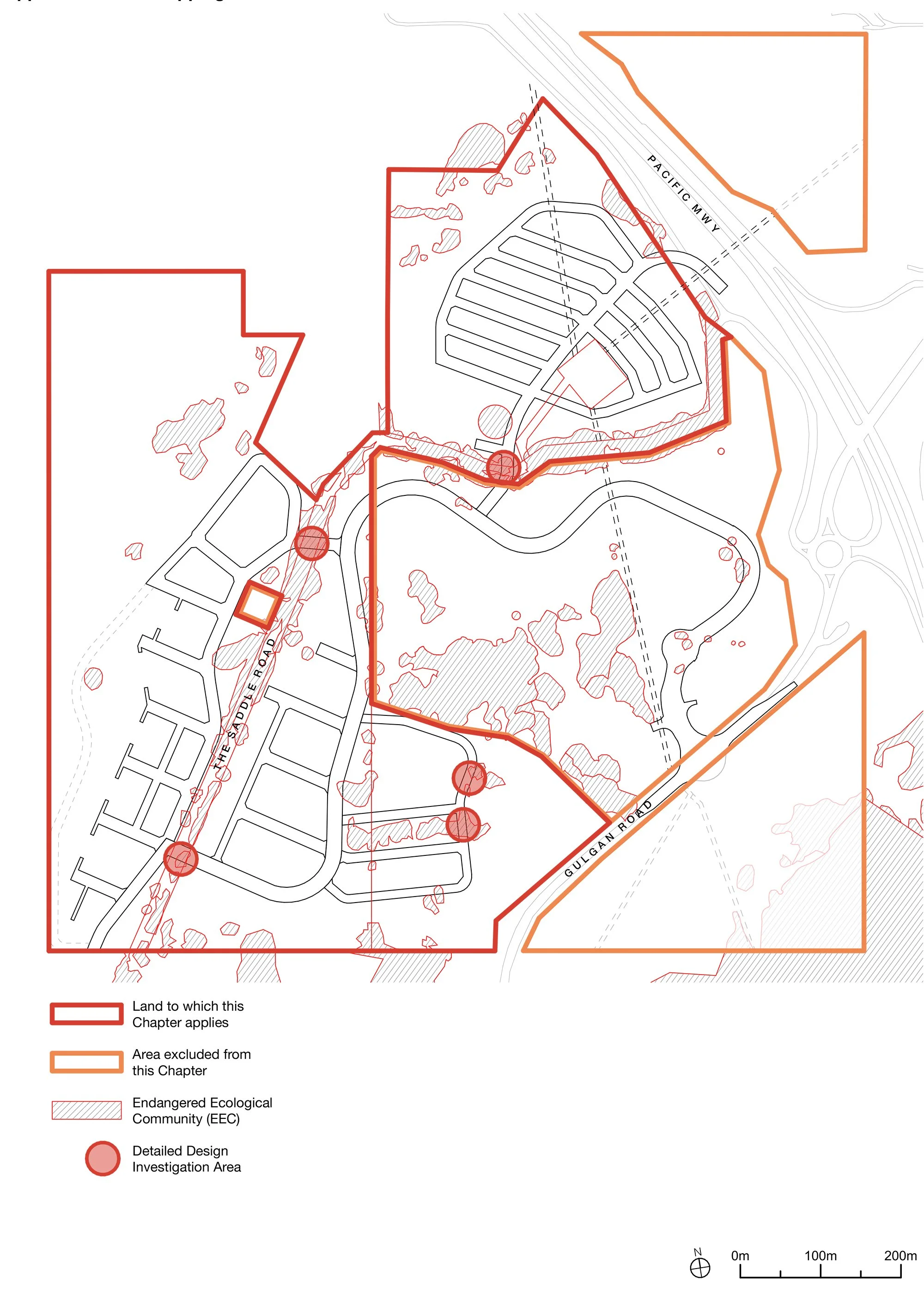
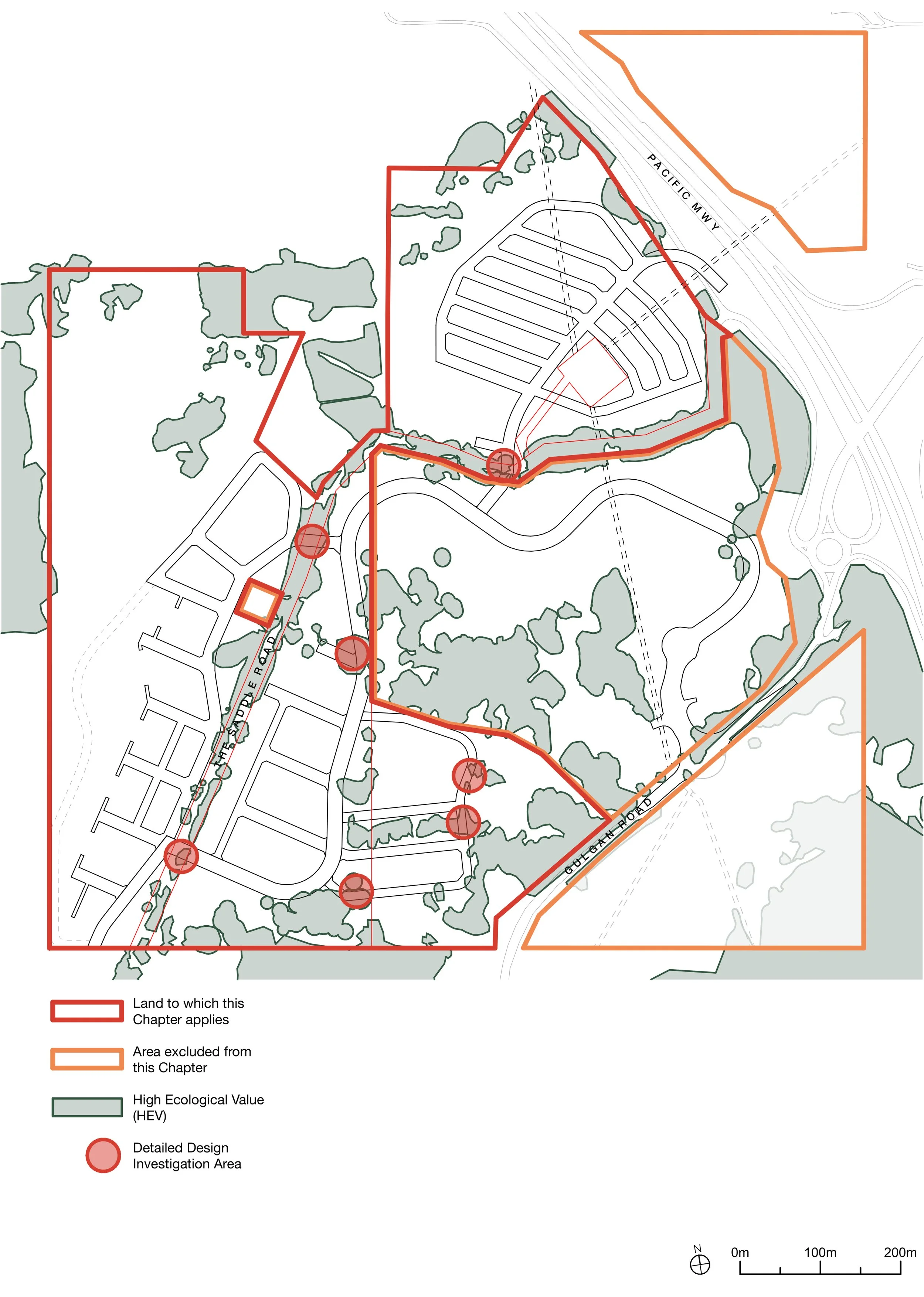
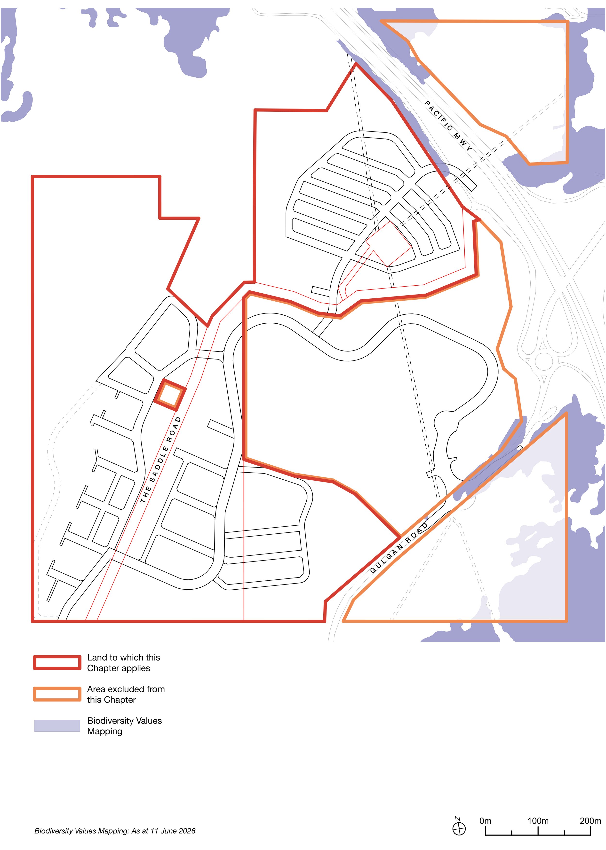
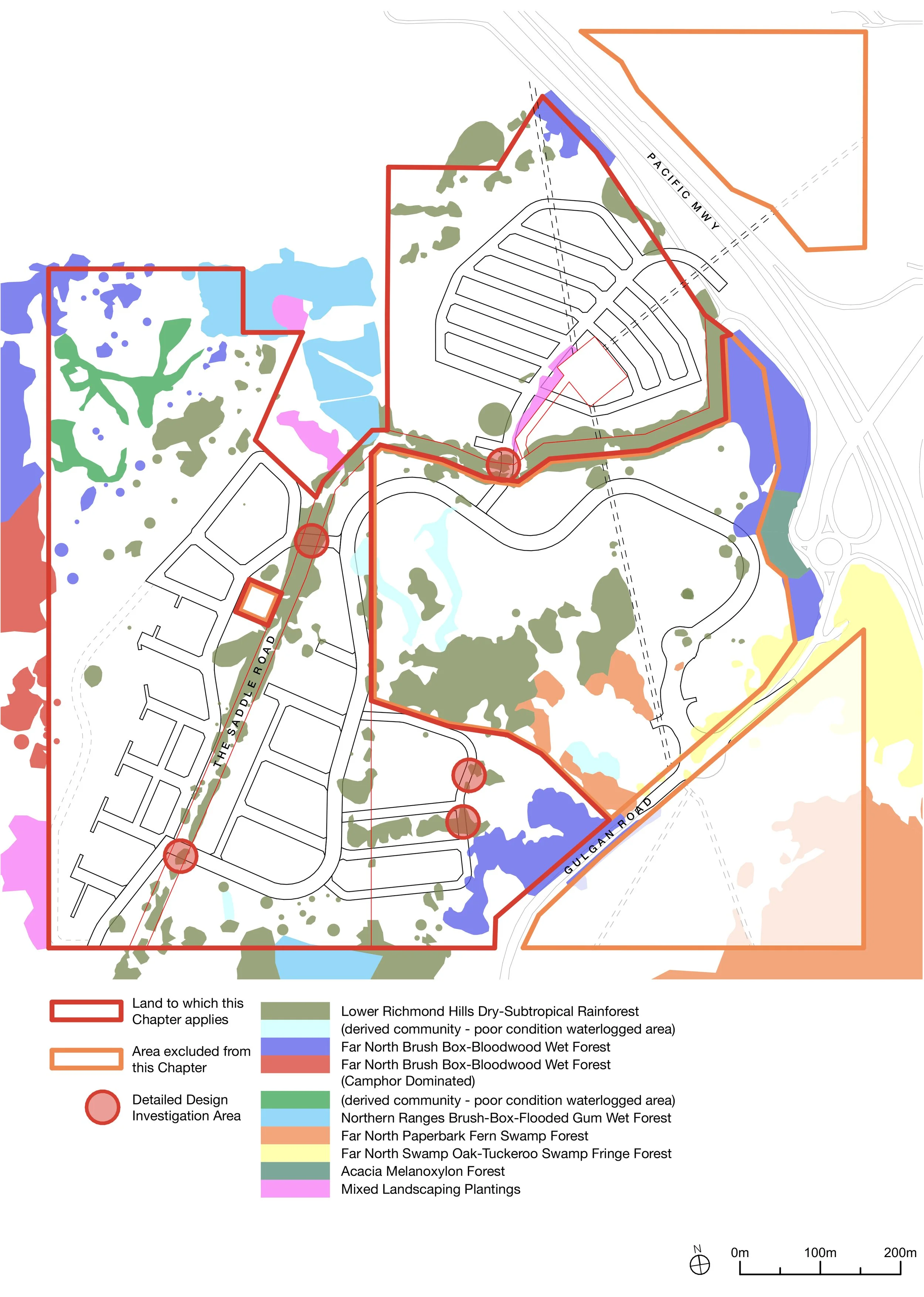
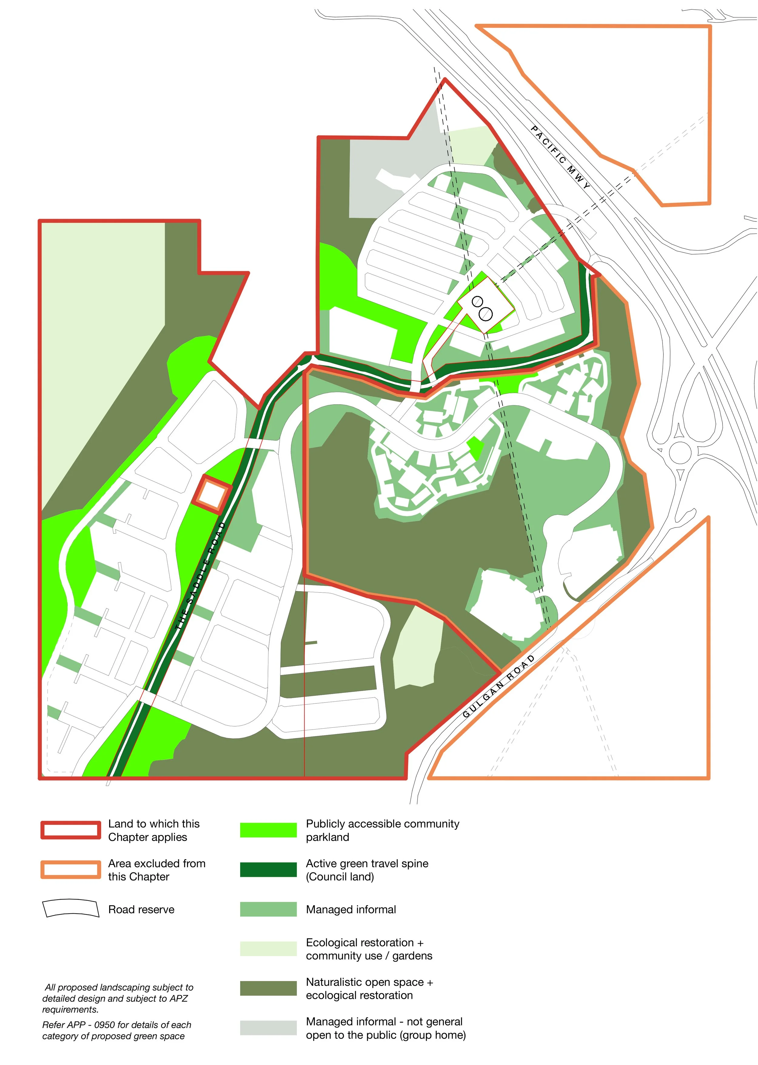
Map: Land to which this Chapter applies
The Gulgan Village DCP,
Chapter E12
Gulgan Village's controls are set out in a new chapter: Chapter E12 of the Byron Development Control Plan 2014. It has its own chapter because the standard Byron DCP chapters were never written for a whole village of this kind, with its range of densities, smaller lot types, housing clusters and undulating terrain.
Chapter E12 runs across twenty sections (E12.1–E12.20), plus two appendices:
E12.1–E12.4: The basics: definitions, an introduction, where the chapter applies, and its aims.
E12.5: The studies and management plans required before the first Development Application.
E12.6–E12.8: How it relates to other rules, the desired future character of the village, and Caring for Country.
E12.9: Subdivision and governance (the backbone — see below).
E12.10–E12.18: Design quality; traffic and access; landscape; ecology; pets and wildlife; stormwater; bushfire; noise; and the neighbourhood centre.
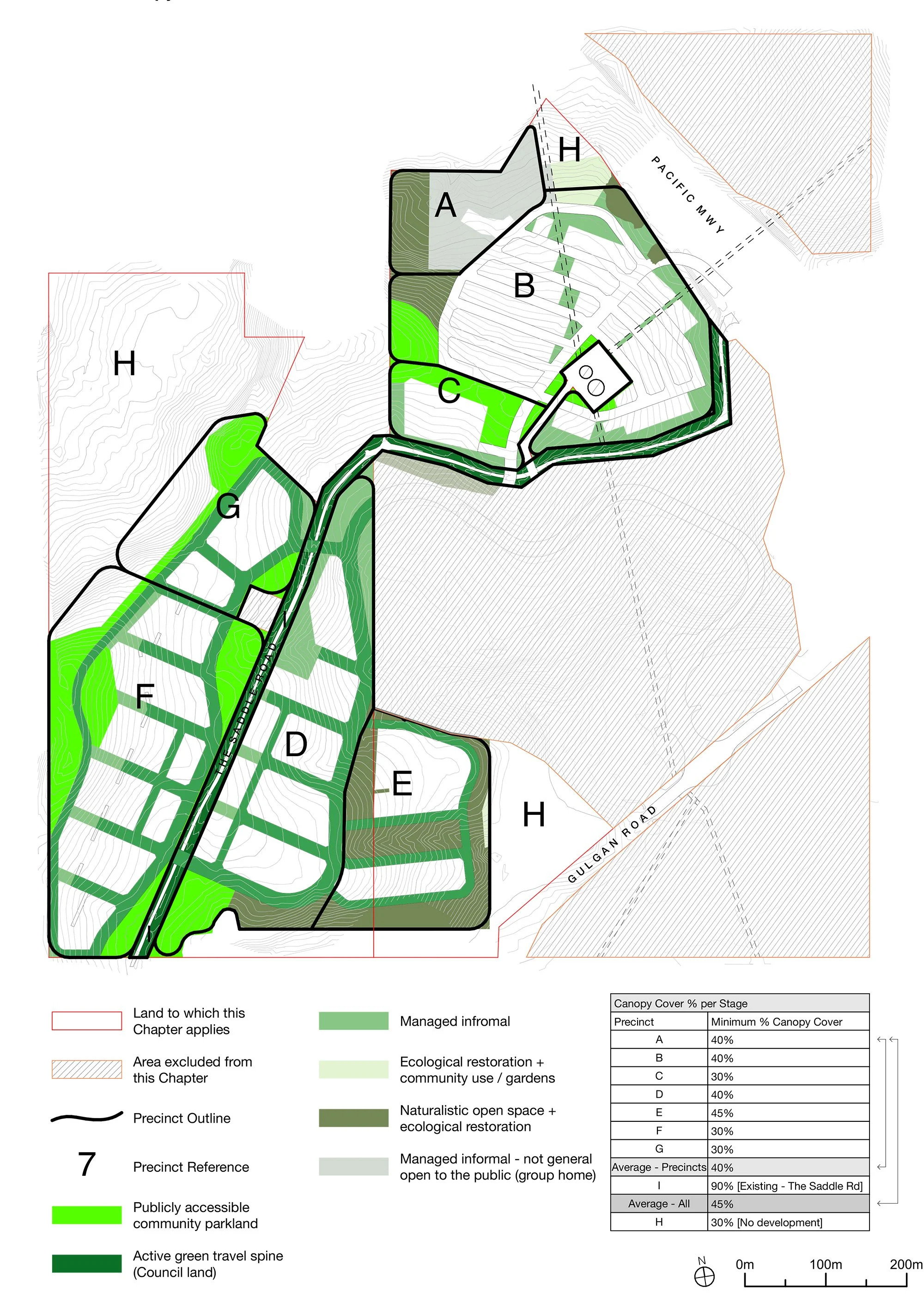
E12.19–E12.20: The manufactured-housing precinct, and the planning principles for each precinct (A–H).
Appendix 1: The management plans.
Appendix 2: Example building-envelope plans.
What the DCP controls
The character of the village
At its heart the DCP describes a village set in a landscape, not a subdivision on a hill. Buildings step down with the slope and sit beneath tree canopy rather than dominating ridgelines, with long views out to Mount Chincogan and Cape Byron; the architecture is subtropical, with shade, verandahs and breezeways suited to the climate. Walking and cycling come before the car, and a genuine mix of housing, from compact and lower-cost homes to family lots and co-housing, is built into the plan from the start.
Caring for Country
Chapter E12 asks that the village's design be guided by a Country-Centred Design Framework, prepared with First Nations expertise, before the first development application, so that connection to Country shapes the layout, landscape and naming from the start rather than being added afterwards. Developed with the Arakwal people, it sits alongside the cultural-heritage protections carried through the management plans (below), as a normal part of planning the place properly.
Getting Around
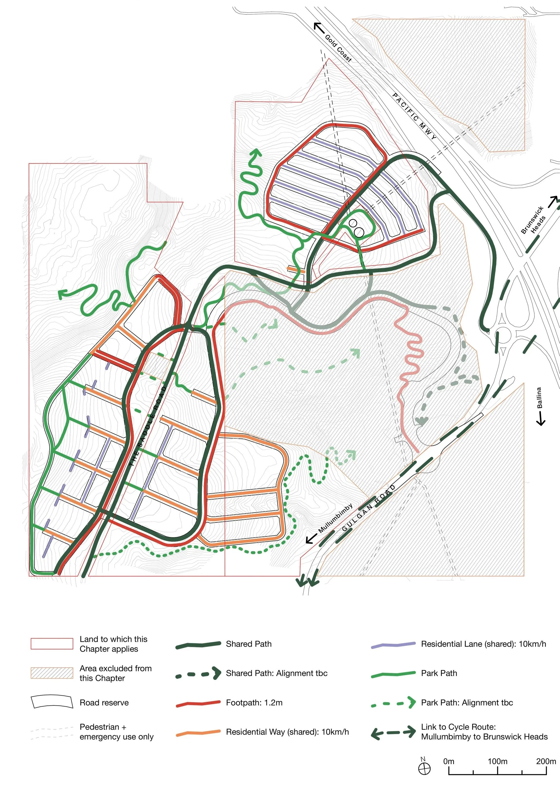
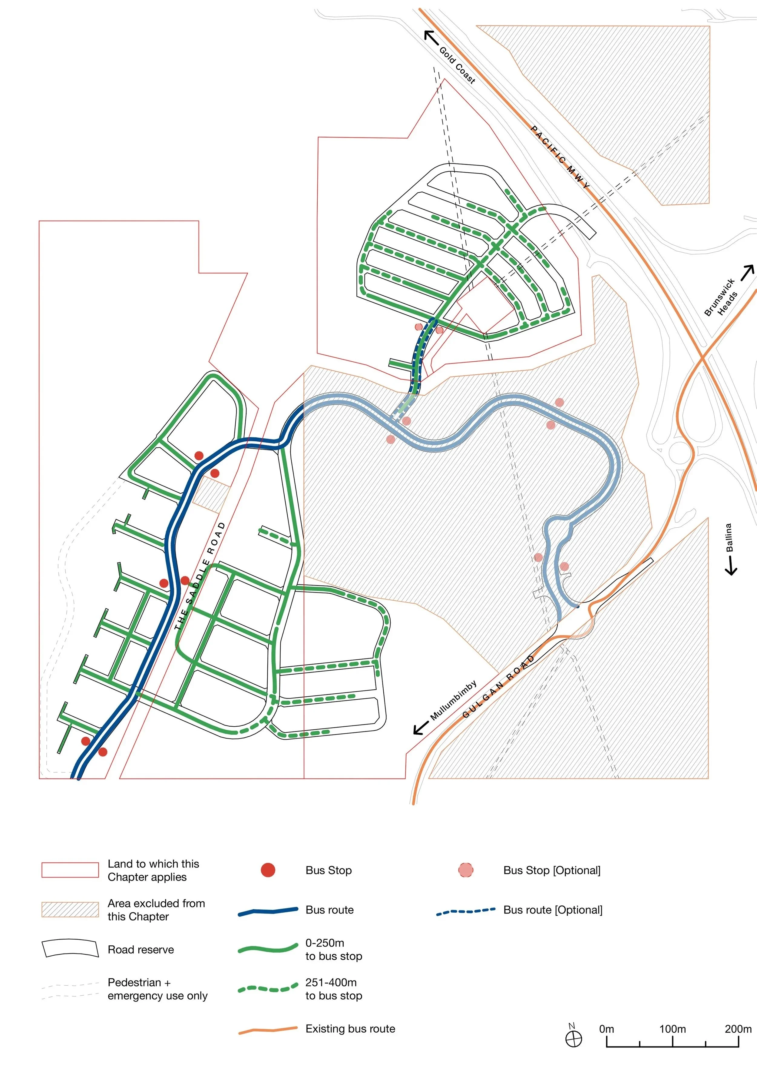
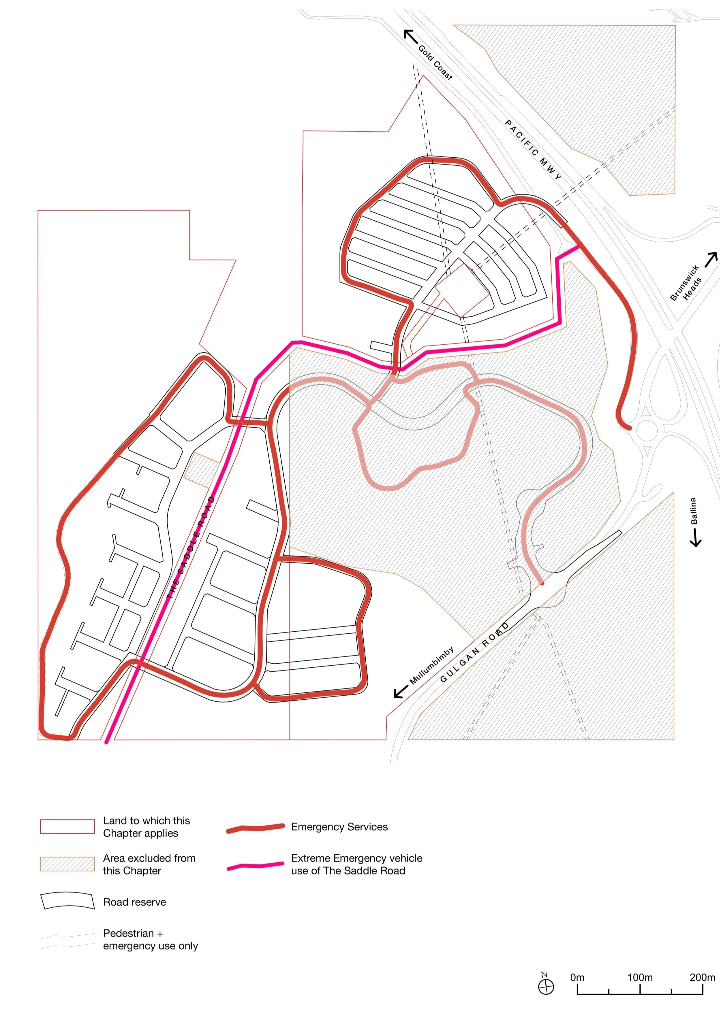
The streets are designed for people first, with a hierarchy of street types from a 40 km/h connector down to 10 km/h residential lanes. There are continuous walking and cycling routes, bus access planned so most homes are within a short walk of a stop, car-share bays and electric-vehicle charging, and at least two independent routes in and out in an emergency.
A village centre and homes
A small neighbourhood centre in the west provides shops, cafés and community uses with homes above, capped at around 1,200 m² of commercial space in total, so it stays village-scaled. Community facilities are to sit within a 400 m walk of most homes. The DCP also enables a dedicated manufactured-housing precinct for faster, lower-cost homes, and allows compact "micro-lots" (80–150 m²), capped at no more than 15% of any precinct, as part of a deliberate mix, with a target that at least 40% of homes are multi-dwelling or small-lot.
Slideshow 1: Map Extracts from The DCP


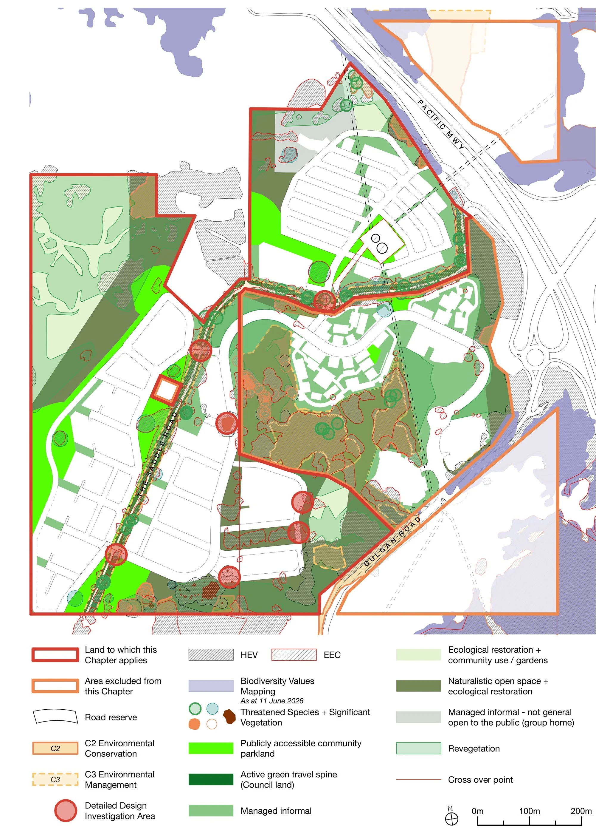
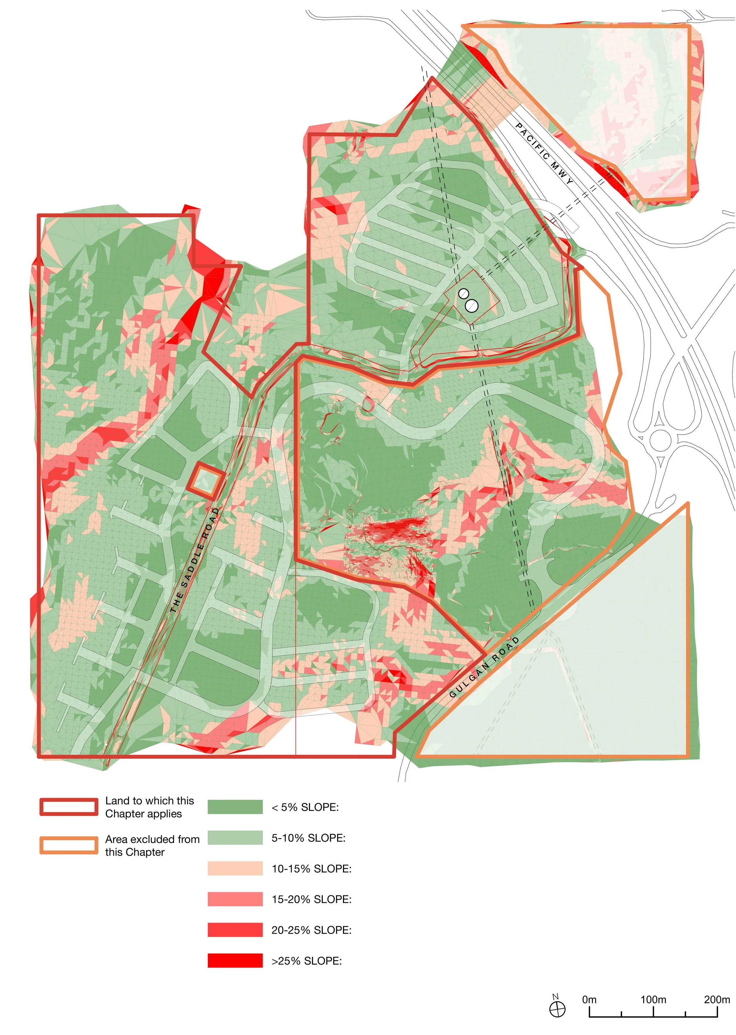
Slideshow 2: Mapping Environmental Constraints


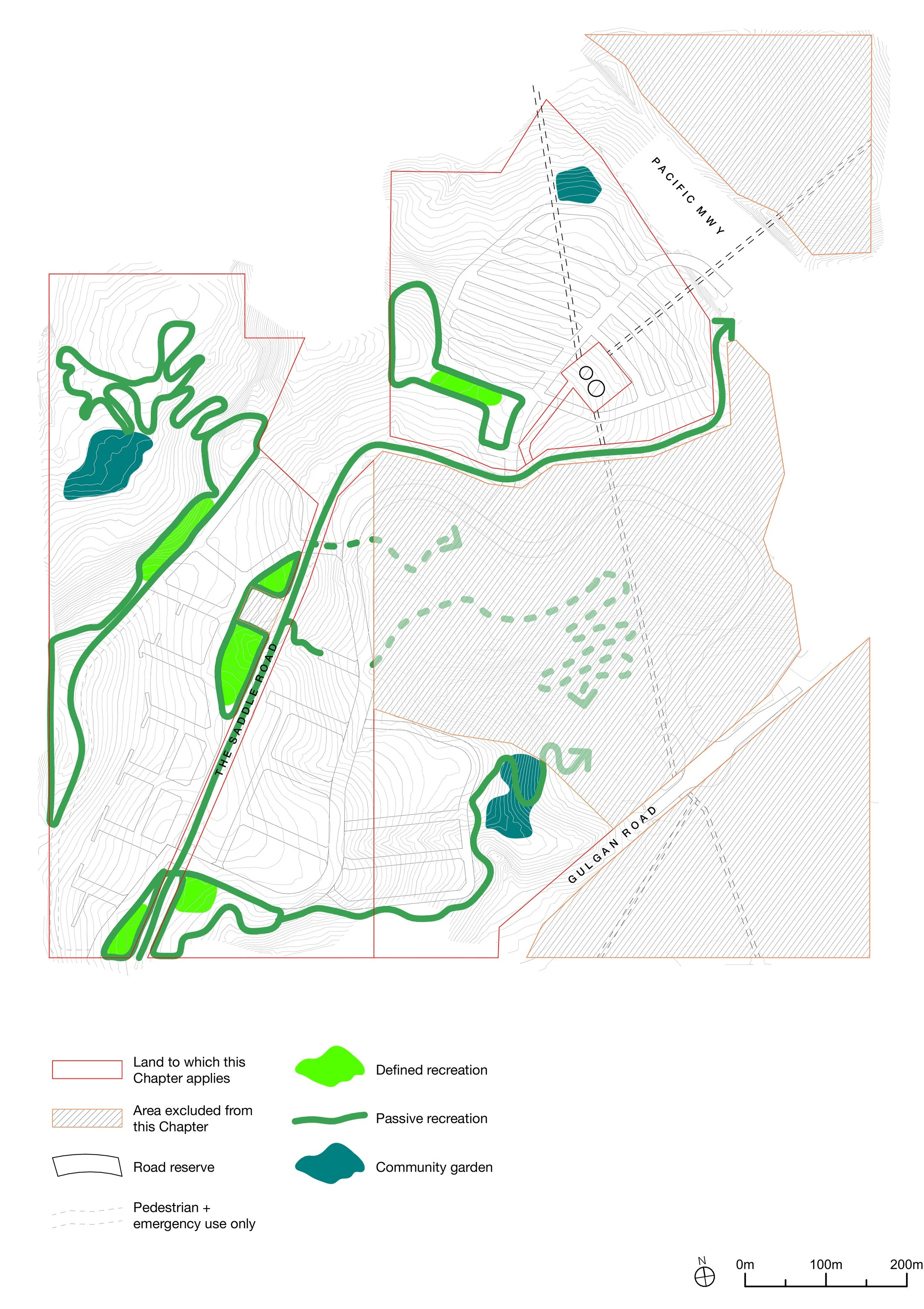
Landscape, open space & trees
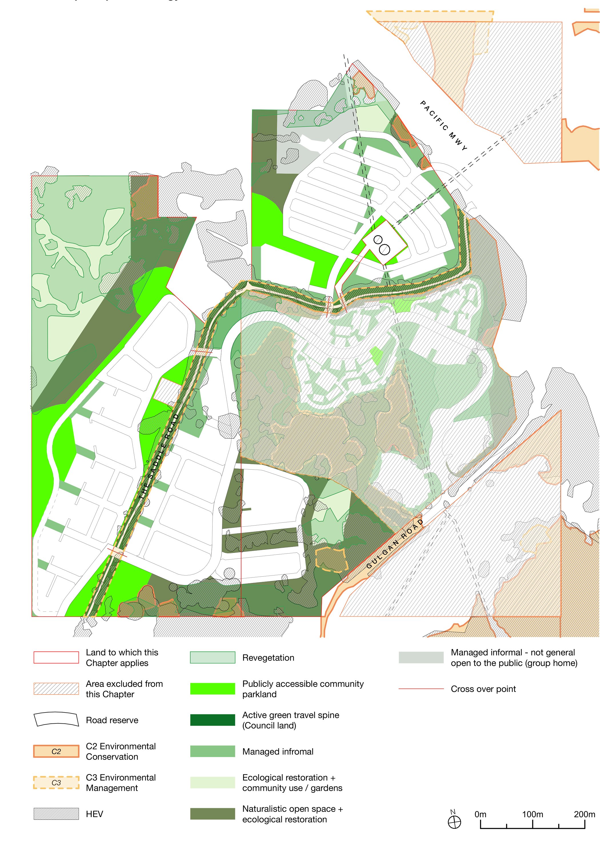
The village is held within a connected network of open space, parks and recreation areas. The DCP sets a minimum tree-canopy target of around 40% at maturity across the development precincts, requires street trees on both sides of streets, and protects key views out to the surrounding mountains and coast. The Saddle Road green corridor ties it together.
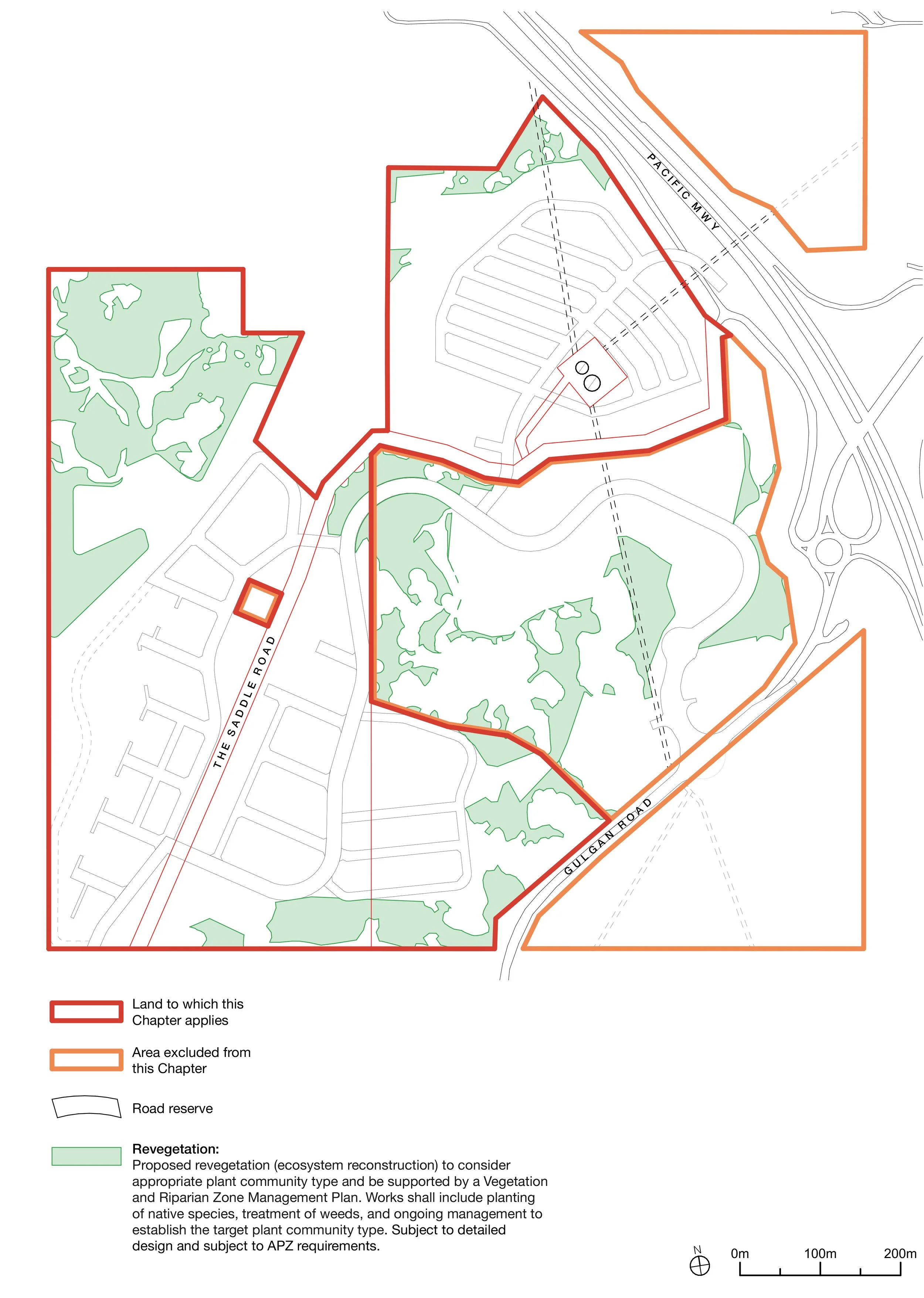
Caring for the environment
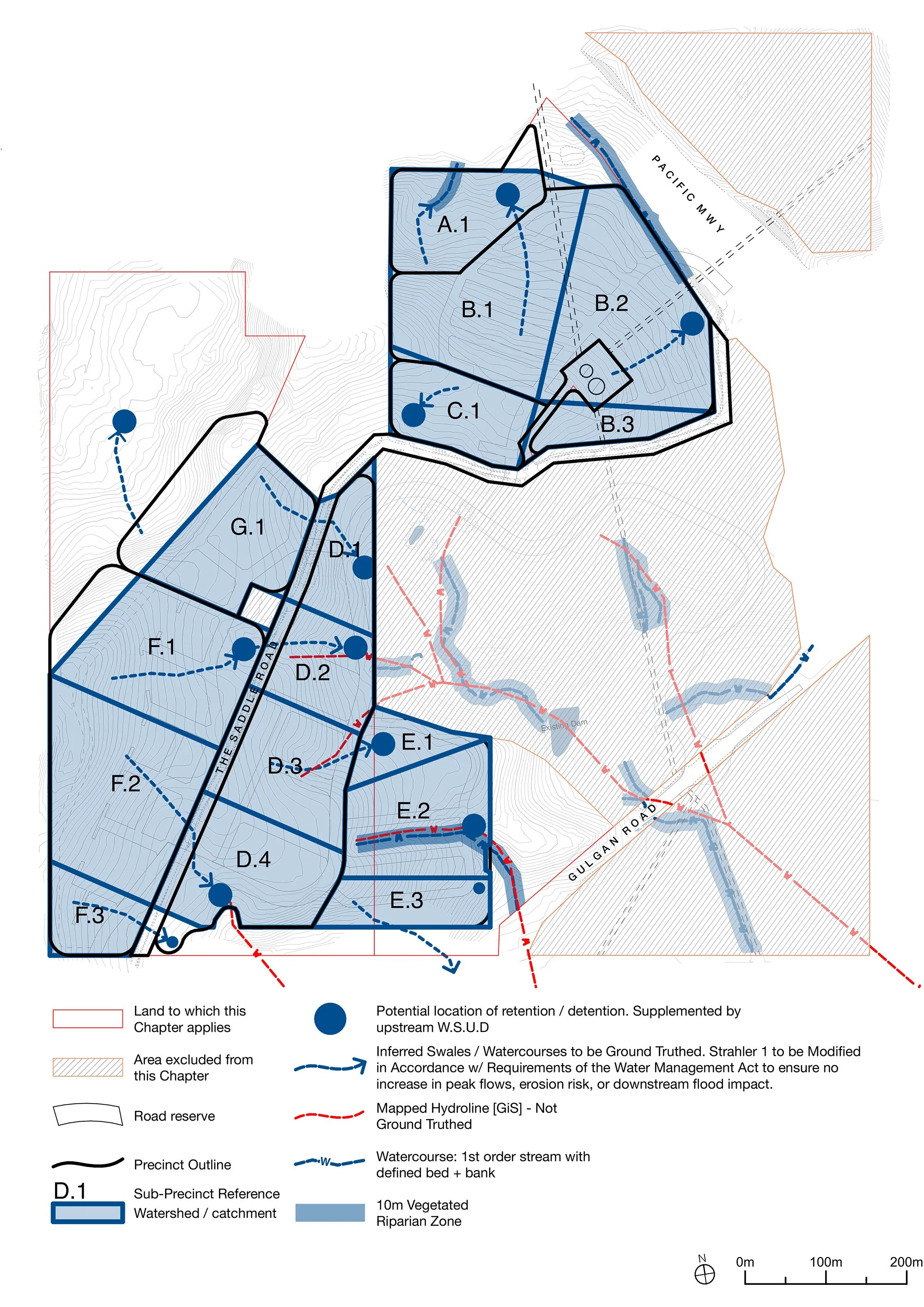
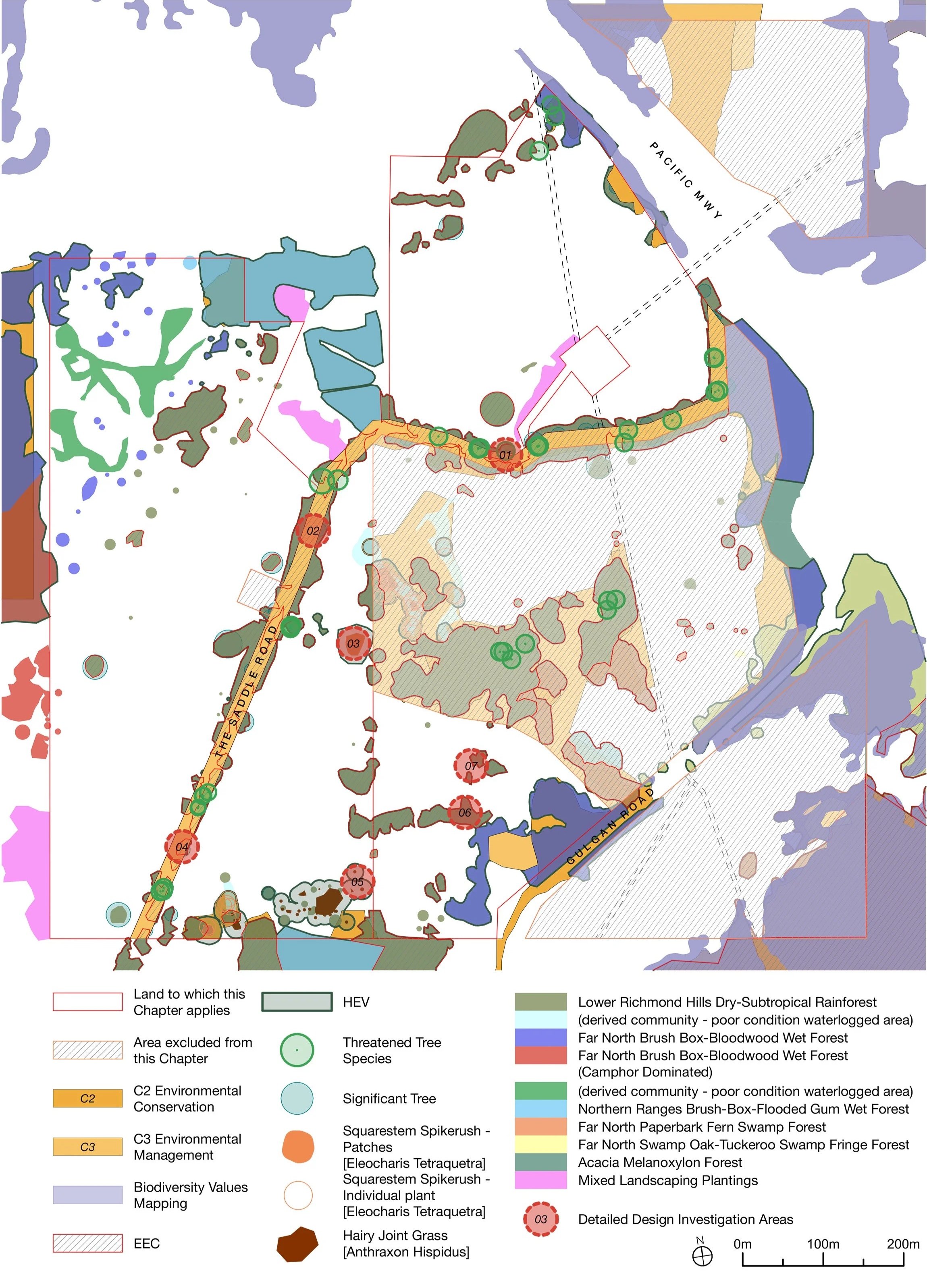
The site's natural values have been mapped in detail: vegetation communities, areas of high ecological value, endangered ecological communities, significant trees and steeper slopes, all set out in the DCP's technical appendices. That work has informed both the Planning Proposal and the DCP, so the controls keep development on land already cleared for grazing, retain the established vegetation and trees almost entirely, and commit the village to revegetation, habitat restoration and long-term care, locked in through binding management plans and the Community Title (below). Water is managed the same way, with stormwater held and treated in the landscape so development doesn't worsen downstream flows.
Living safely with the site
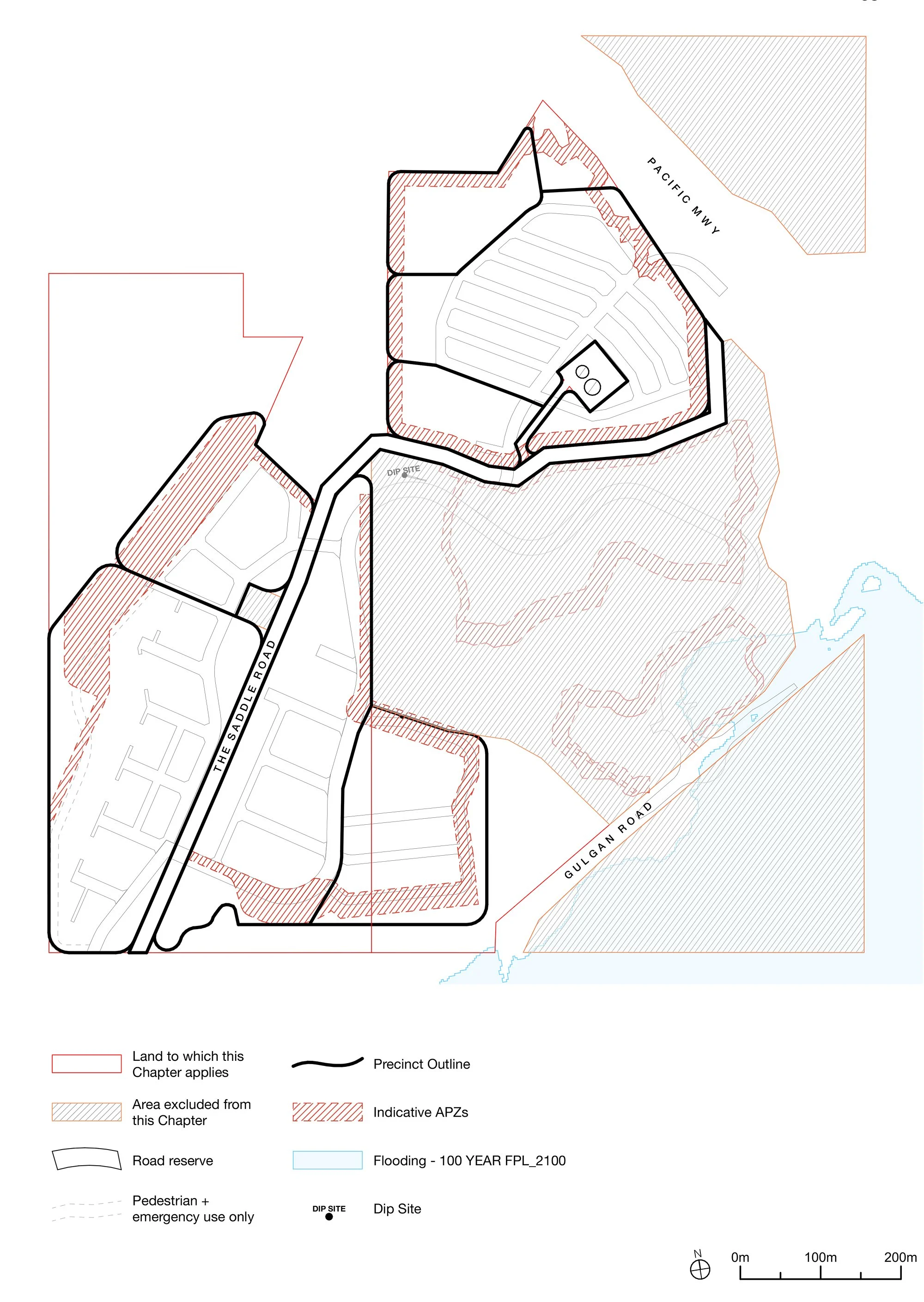
Bushfire risk is resolved at the subdivision stage to the NSW Planning for Bushfire Protection 2019 standard, with asset-protection zones held within lots and public land rather than encroaching on the conservation areas, and at least two access routes. Homes near the motorway are laid out and built to meet internal noise-comfort standards, with the required treatments mapped across the site.
How it’s delivered, and held in place
A few key mechanisms do the heavy lifting here, and they're worth understanding because they're how the village's quality and care are held over the long term, not left to goodwill.
A single Community Title scheme. Rather than a conventional subdivision of separately-owned lots, the whole village would be created as one Community Title scheme under the Community Land Management Act 2021. A shared Community Lot holds the conservation land, internal roads, drainage, bushfire zones, ecological buffers and communal open space as common property, so the green and shared parts of the village can't be sold off and are managed by one overarching body. (Standard Torrens-title lots aren't used, except where Council needs them for its own assets).
A Community Management Statement. Registered on the title and binding on every current and future owner, this statement locks in the obligations that keep the village working: protecting the conservation land, maintaining bushfire and stormwater systems, regulating pets near bushland, and securing Aboriginal community access to cultural places. It carries the architectural and landscape standards too.
Building Envelope Plans. This is the DCP's principal design control. Before lots are created, a Building Envelope Plan sets, for each one, where and how big a building can be, its height, setbacks, solar access (at least two hours of midwinter sun to living areas and private open space), no-build areas and bushfire zones. It's what lets the village use a genuine variety of lot types and respond to the slope, while still guaranteeing good outcomes.
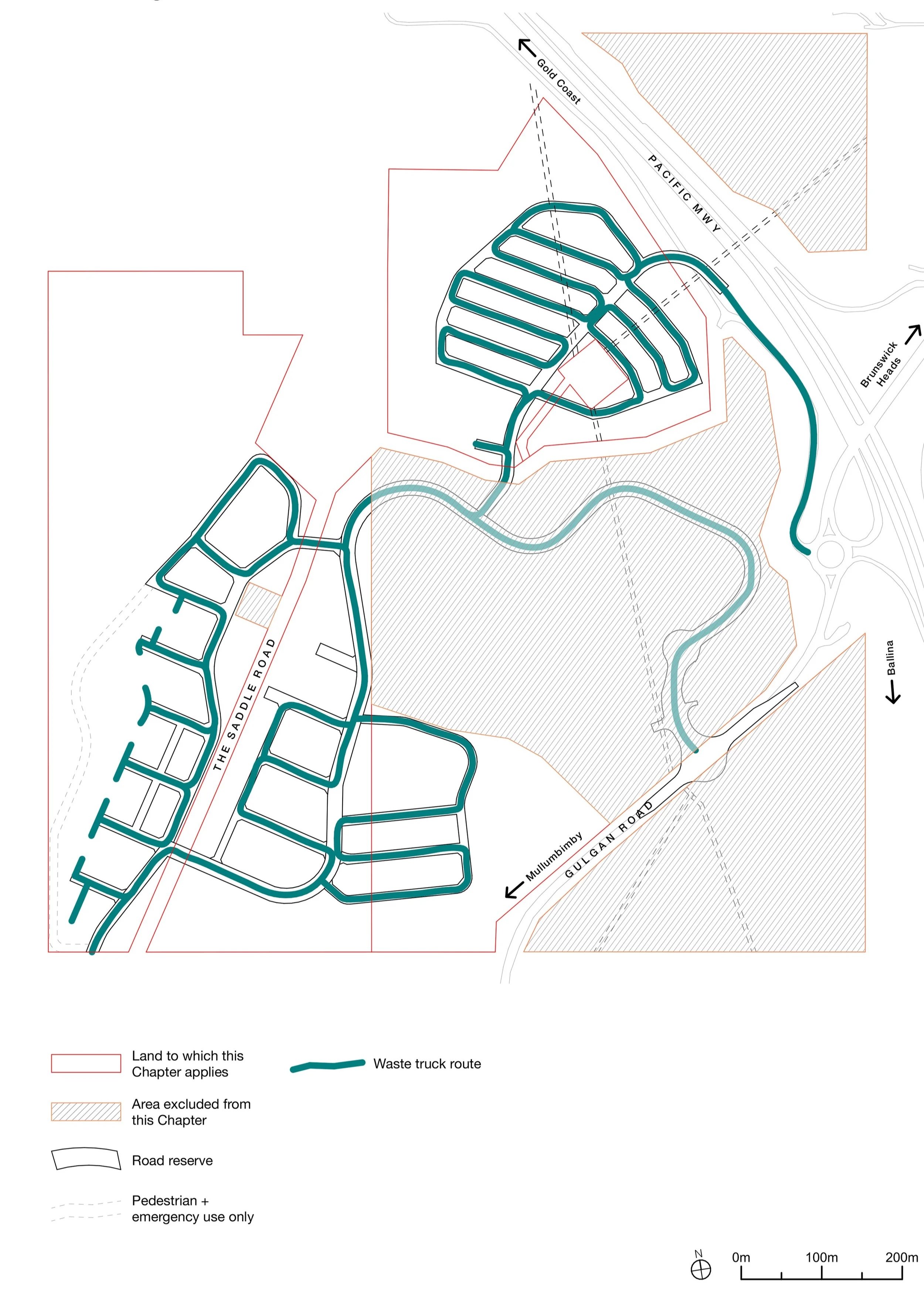
Management Plans. Before the first development application, the DCP requires a suite of studies and management plans to be prepared and signed off, covering staging, contamination, acoustics, Aboriginal engagement and cultural heritage (ACHMP), biodiversity (BCMP), vegetation and riparian zones (VRZMP), stormwater and hydrology (SHMP), waste (WMP) and overall environmental management (EMP). Together they make sure the detail is resolved, and the commitments made binding, before anything is built.